Ride Report: Pittsburgh to Oakmont
There are two breweries I want to visit. One, called Acclamation Brewing, is in a town called Verona, which is a bout eight miles North-East of my neighborhood in Pittsburgh. The other, Local Remedy, is in Oakmont (where the big Golf tournament is held), two miles North of Verona.
These breweries are both in my stamp book. So, by the rules of my game, I must take the bus or ride my bike to these breweries if I want to collect their stamps. There is a bus route that boards really close to my apartment and drops off just a few blocks away from Acclamation: the P78. From there I could probably walk to Local Remedy and then back to the bus stop.
I think it would be more fun to ride my bike here, though. Normally, I do the vast majority of my riding either a) in the denser part of Pittsburgh that has pretty decent bike infrastructure, or b) on the multi-use trails that run along the rivers and through the parks around town. This ride, however, takes place almost exclusively on suburban boulevards and state highways. These types of roads are perfectly legal to cycle on in Pennsylvania, but cyclists and pedestrians are undoubtedly at the very bottom of the hierarchy in these settings. Most of the mileage on the most direct candidate routes doesn’t even have sidewalks. This ride will take me considerably outside of my comfort zone. So, to make sure I don’t have an awful time, I’m going to do some planning and try riding smaller segments of the ride out. If it ends up feeling too sketchy, I’ll just take the bus.
Initial Research
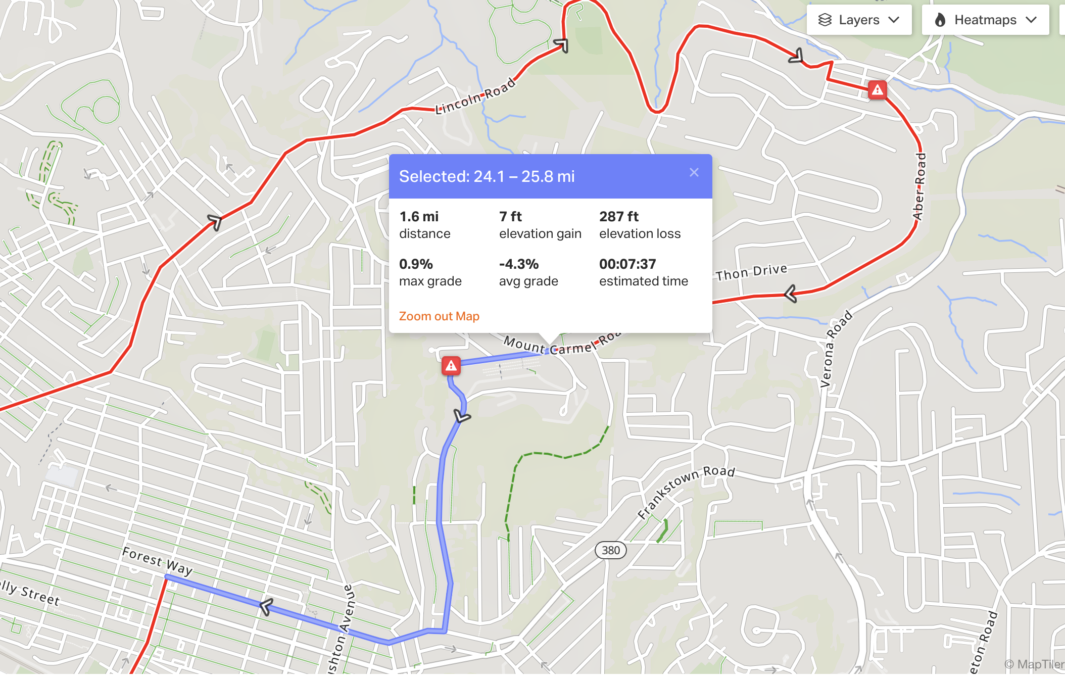
I spent some time looking at the global heatmaps on Strava and RideWithGPS. According to the the heatmaps, the most traveled routes between Pittsburgh and Verona, which will be my first stop, start by taking Lincoln Ave through Larimer. A mile-ish East of Larimer the heatmaps fork, though. The upper path continues down and around Sunset View Cemetery. And the lower path climbs up and around Mt. Carmel Cemetery. The paths converge at the Green Belt near Sandy Creek. From there it’s all down hill and flat on some state routes with mostly reasonable-looking shoulders for the final three mile stretch.
The upper path requires slightly less climbing than the lower path. Both roads are only two lanes wide and Google street view shows they both have shoulders that occasoinally disappear.

Testing Paths to the Green Belt
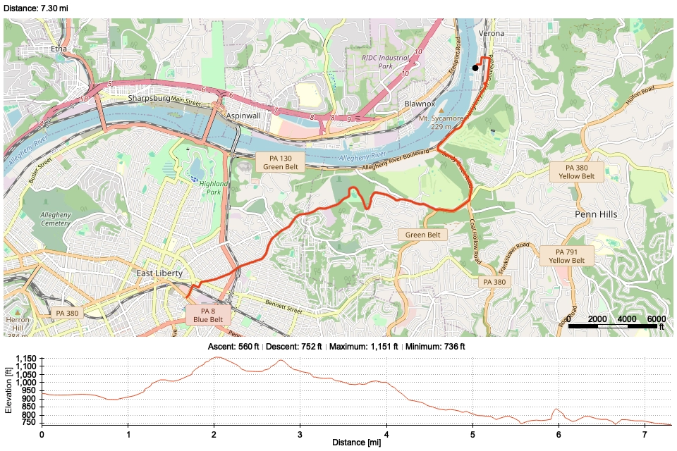
I decided I just needed to go ride both paths to decide which one feels better. So, on September 27 I planned to go for a ride to try the Mt. Carmel route (the lower path), and to turn back once I got to the Green Belt segment. I ended up doing exactly this. But, when I got back to the fork I was still feeling fresh and my nerves actually weren’t too fried from negotiating with the cars! So, I decided to try out the upper path before heading back home. This path descended a lot more after its peak, but the climb back up to the fork wasn’t as grueling as I feared. I also found a cool ring road with a great view of the Allegheny River when I passed the cemetery on the way back up.
The total mileage of the ride ended up being more than the outbound eight miles of the final route 😅, but I’ll just chalk it up to practice.
When I do make the journey up to the breweries, I think I’ll take the Mt. Carmel route. It feels less boulevardy than the upper path, since it passes by a bunch of houses, churhces, and a few businesses. This quality made me feel safer.
Avoiding High Speed Roads to Verona
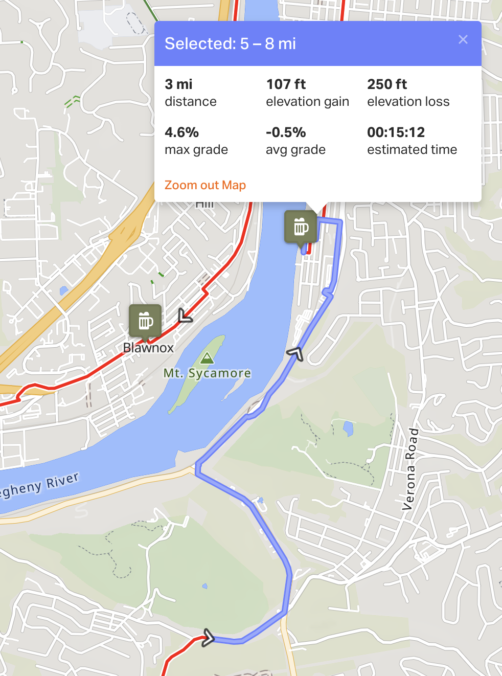
I think I found a route that trades some extra climbing for much less time on high speed roads with tiny shoulders. Instead of turning down Sandy Creek Road toward Allegheny River Boulevard, I might snake through a neighborhood and pop back out on to Verona Road after its peak.
Update 2025-09-29: New Route to Mt Carmel
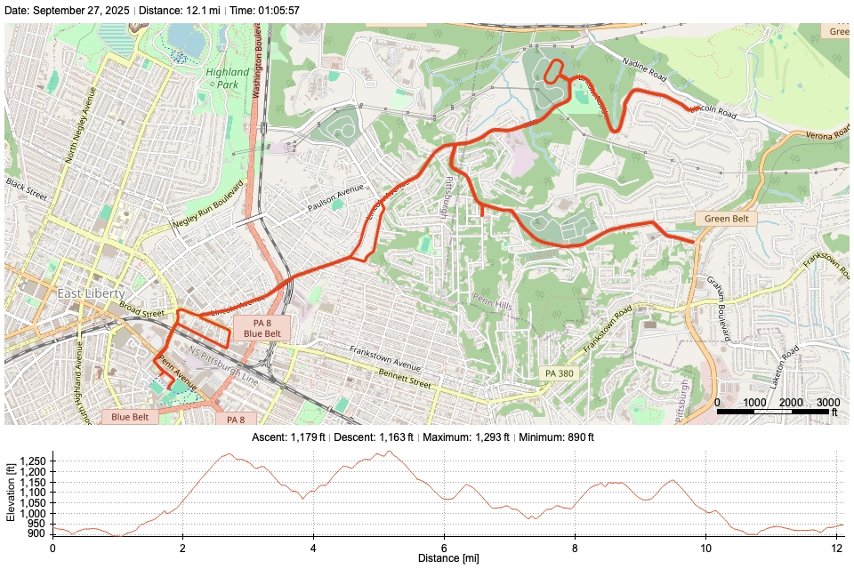
This afternoon (September 29) I went to test an alternative route to Mt. Carmel. It goes East through Homewood, then climbs up through Lincoln Park, where it meets Mt. Carmel. There are several long alleys that run parallel to Hamilton Ave and Frankstown Rd. These can be used to really cut down on time spent riding next to cars. I remember seeing this in the map part of the fourty mile route for Pedal PGH that I skipped. It’s much less prominent in the RWGPS heat map, so I didn’t consider it before.
The climb up Blackadore St. felt a touch more intense than the climbs I tried in the previous section. I did, however, take a wrong turn that led to me having to climb the middle 100 ft twice… There were basically no cars on this climb, though! And I did it right around rush hour. So, I think this might be the way I end up going for the final ride.
Here’s the route I rode on RWGPS: https://ridewithgps.com/trips/337923706
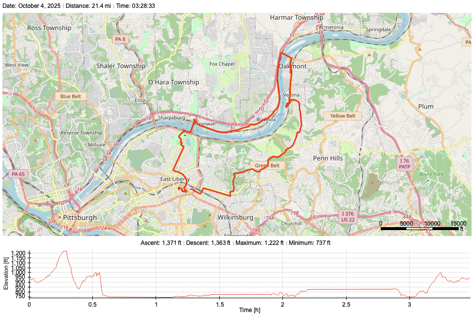
Update 2025-10-04: Did It!
I did this ride today, October 4th.
To get from Acclamation Brewing (lovely spot!) to Local Remedy, I found a rail maintenance path that crosses Plum Creek and dumps out in an Oakmont neighborhood. The route to Local Rememedy from there just required riding through some alleys.
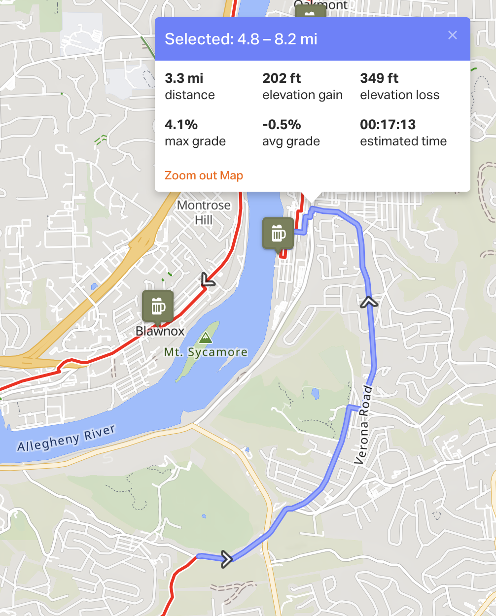
I decided to also visit Old Thunder Brewing in Blawnox on the way home. I did this for two reasons. First, I wanted to ride across Hulton Bridge, which I haven’t ridden across before. Also, from Old Thunder I could climb home through the Highland Park Zoo, which I know to have a comfortable bike lane the entire way up. This was much more comfortable than retracing my steps in the comparatively narrow shoulder of Verona Road.
The descent from Mt Carmel toward Sandy Creek Road was stunning! It winds alongside Sandy Creek in between two massive hills. There was a reasonably wide shoulder to ride in, but using it wasn’t necessary given how much momentum you gain going down hill.
Check out the entire route on Ride With GPS.
Published on September 27, 2025